
You're here: MiBSAR's home page :: Trip beta page
9-day Michipicoten Island Backpacking Expedition
May 26 to June 3, 2012
Michipicoten Island Provincial Park
(A non-operating park in the northeast corner of Lake Superior)
Thunder Bay District
Wawa, Ontario, CanadaLast revised on Sunday, August 21, 2016 4:38 PM
|
|||||||||||||||||||||||||||||
|
 Forewarned
is forearmed
Forewarned
is forearmed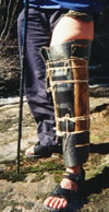 Accidents
and injuries
Accidents
and injuries Medical
and dental exams
Medical
and dental exams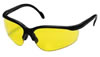 Safety
glasses
Safety
glasses Cotton clothing
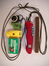 Survival
kit
Survival
kit Allergies
to bee stings
Allergies
to bee stings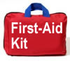 First-aid
kit
First-aid
kit Emergency
medical care
Emergency
medical care Search
& rescue
Search
& rescue Insurance
 Emergency
communications
Emergency
communications

The expedition
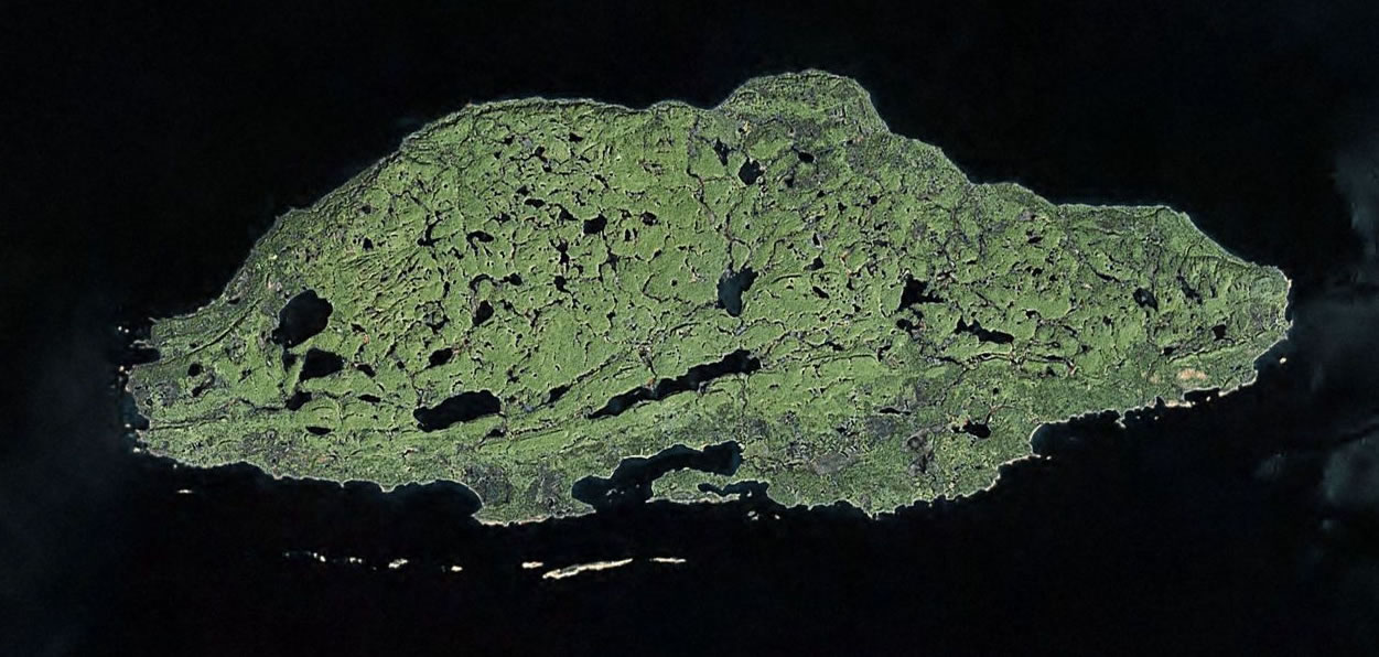
During this free, public adventure, we'll spend 9 days exploring the north shore of Michipicoten Island, the third largest of Lake Superior's islands.
Note: This expedition is only open to expert backpackers who are very physically fit and who have completed prior trips with the undersigned, preferably a Canadian Expedition.
For the latest info about this trip--including who is participating, route info, land nav info, adivisories, etc., read the trip discussion thread on Backpacker Magazine's Midwest Forum.
While the island was designated as Michipicoten Island Provincial Park in 1985, it is a closed, non-operating park, with no facilities, trails, or transportation service etc.
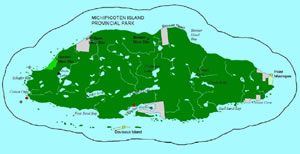
Approximately 26 kilometers long and 10 kilometers wide, the following parcels are not part of the park:
- 8 private parcels in Quebec Harbor
- 4 patented lands elsewhere on the island—one on the northern shore near Bonner Head, one on the old Philips Mine site (northwestern corner of the island) and two locations on the eastern shore of the island
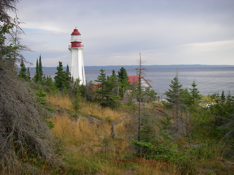
- 4 federal, Department of Transport properties—two lighthouses, two beacon locations.
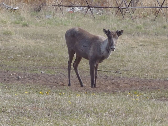
The island is home to an abandoned commercial-fishing operation, several abandoned copper mining operations, an old mining railroad, an old log jail, several old lighthouses, shipwrecks (some visible), endangered plants, and over 200 woodland caribou, the southernmost herd in the province.
Michipicoten Island is Canadian Shield bush. Exposed rock formations include Jacobsville, Freda, Michipicoten, and Mamainse Point.
The island's landscape is defined by east-west cuestas (hills with both a vertically-faced side and a gently-sloping side) as well as glacially- and fluvially-eroded valleys.
While the island's interior is pock marked with lakes, it's coastline is made-up of numerous sand beaches, gravel coves, ancient raised cobble beaches, sea caves, flower pot formations, and jagged cliffs.
The Ontario Ministry of Natural Resources on Michipicoten Island:
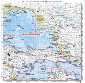
Michipicoten Island is the third largest island in Lake Superior. It is located in the lake's northeastern corner approximately 65 kilometres southwest of the town of Wawa....
At its closest point, the island is located 16 kilometres south of Lake Superior Highlands Conservation Reserve on the mainland.
Michipicoten Island, its surrounding islands, and much of the Lake Superior basin were formed by volcanic activity that occurred in few other places in the province.
This volcanic activity along with glacial activity and weathering has provided the remarkable geological features associated with the island.
The island harbours a variety of provincially and regionally significant plants and animals including arctic relics and one of the southernmost populations of Ontario's woodland caribou.
The island provides an ideal environment for studying plants and animals due to its isolated location and the absence of industrial and other land uses.
Aboriginal myths and past activities on the island such as small-scale copper mining, commercial fishing, trapping and lighthouse operation since the 1800's enhance the cultural significance of the park.
Park use is relatively low. Access to the island is limited to tour operators, commercial fishing vessels, float planes and recreational watercraft.
Park visitors are awarded with a variety of recreational opportunities including wildlife and landscape viewing and photography, canoeing and kayaking, boating, diving and hiking along the island's rocky and sandy shorelines.
According to those familiar with this archipelago, sea kayakers and boaters have visited the island from time to time, but few, if any, backpackers have ever explored its tangled, "jungle-like"interior (my long-time sources know of none, and they describe the island's bush as being 5 times more tangled than the mainland's).
Based on our first 9-day recon of the western third of the island in 2012, its some seriously-rugged-and-tangled bush, but not as bad as we've traversed elsewhere. Blog post and video from 2011 expedition.
Expedition advisory: This is an expedition, not a highly-scripted trek through well-traveled bush. The organizer has never visited or explored this bush, or talked with anyone who has. Like most of his expeditions, the route was laid out after pouring over detailed quads and reviewing satellite imagery. Come prepared for an adventure; expect the unexpected; be ready to improvise, adapt, and overcome...
Swift-water/deep-water crossing advisory: Since our area of operation is laced with lakes, rivers, streams, waterfalls, steep terrain, and perhaps flooded slot canyons, we will likely be making numerous water crossings of lake narrows, rapids, river pools, and perhaps ascending or descending straight through flooded slot canyons. While some may be fordable, others may require swimming. Participants should be proficient swimmers—get in a pool or lake and swim a couple 1,000 meters so you are one with the water again before the expedition.
To float your ruck: Line your critical stuff sacks with heavy-duty garbage-compactor-type plastic bags; line your entire ruck with a heavy-duty contractor-grade plastic bag (the barrel-sized ones contractors dispose of building debris in); and wrap your ruck in a tarp or a full-coverage, watertight rain cover.
Improvised PFD: In the bush, fashion an improvised PFD by rolling up your closed-cell sleeping pad lengthwise, lashing it into a noodle and attaching a long shoulder loop of cordage so you can tow it behind you, always at the ready.
Warm clothing advisory: Bring plenty of warm clothing, as well as an extra set of essential clothing in case you get wet, as this area is known for its cold, windy, wet weather, due in part to its proximity to Lake Superior.
Campfire advisory: Do not plan on having warmng or cooking fires as we will be working hard just to find body-sized bivouac spots in many areas. And much of this region is pristine, scar-free wilderness where it would be inappropriate. Also, the fire hazard may be high, perhaps so high that the Ministry of Natural Resources may have a full fire ban in place.
Bivouac advisory: We will be working thick, tangled, untrammeled bush, so all of our bivouacs will be challenging at best.
Journals from Michael Neiger's prior spring Canadian expeditions
2011 :: 2010 :: 2008 :: 2007 :: 2005 :: 2004a :: 2004b :: 2003 :: 2002 :: 2001
Photo albums from Michael Neiger's prior spring Canadian expeditions
2011a :: 2011b :: 2011c :: 2011d :: 2011e :: 2011f :: 2011g :: 2011h :: 2011i :: 2011j :: 2011k :: 2011l :: 2011m :: 2011n :: 2010a :: 2010b :: 2010c :: 2009 :: 2009 :: 2008a :: 2008b :: 2008c :: 2008d :: 2008e :: 2007 :: 2006 :: 2004a :: 2004b :: 2004c :: 2003 :: 2002
Itinerary
May 25 lodging option: Those looking for lodging should consider the White Fang Motel (1-877-399-2672 or 1-705-856-0344), which is located along the east side of Kings Highway 17, just north of the big bridge over the Michipicoten River, and south of Wawa, Ontario.
May 26 assembly location: Our 6:30 a.m. pre-trip assembly location will be the the parking lot of the White Fang Motel. Everyone should have eaten and be squared away for 9 days of high adventure.
Note: Insertion and extraction arrangements by helo, fixed wing, or watercraft are pending and will be e-mailed to participants when they're finalized.
May 26-June 3 itinerary: Our 9-day route on the island will be dictated in large part by where the weather Gods allow us to be inserted on or around the island.
The tentative plan is to explore the north shore of the island, including a bivouac at the Point Maurepas Lighthouse on the extreme eastern tip of Michipicoten Island. If time permits, we'll also attempt to locate and document the remains of the 1875 Philipps Mine, east of Bridal Veil Falls, and the 1853 Bonner Mine inland from the Clay Banks.
Getting up and around behind the cliffs of the north shore--especially Bonner Head--will be an extreme, potentially-dangerous physical undertaking involving climbing and technical navigation.
Note: A provisional itinerary/route map will be e-mailed to participants when it is completed.June 3 extraction: If all goes well, the plan is to get extracted from the island early on Sunday, June 3.
Notice: The dates allotted for this expedition do not include travel days to and from the north shore area, nor do they include a couple extra days in case our extraction from the island is delayed by rough seas, heavy surf, fog, stormy weather, mechanical problems, human error, etc.
Participant requirements
Participants muist be adults (18 or over) who are experienced, fully-equipped, foul-weather campers who enjoy wilderness adventures with hordes of biting insects and without campfires, tobacco or alcohol products.
Note: due to the nature of this expedition, participants must have completed at least one prior backpacking trip with the organizer.
Participants must be swimmers and in very good physical condition as this adventure is not suitable for the unfit or overweight.
Bivouacs will most likely be in pristine, non-campground settings.
Camping permits: since the park is non-operating, each participant will need to purchase 8 night's worth of $10-a-day Crown Land Camping Permits prior to the trip.
These are sold whereever fishing and hunting licenses are sold. One of the best places to purchase them is at the Chippewa Trading Post, which is located along the east side of King's Highway 17, just as you are leaving Sault Ste. Marie, and heading north.
Chippewa Trading Post
1332 Great Northern Road
Sault Ste. Marie, Ontario P6A 5K7
1-705-759-4518
Fax: 1-705-759-0887
Costs: While this is a free trip, group expenses will be split evenly among all participants and will include
- the cost for the rental of an Iridium satellite phone
- the cost for getting inserted and extracted from the island.
Specialized equipment
 Water-hauling
capacity: Everyone should have the containers—water
bottles and bladders—to haul 4 quarts of water if needed. While
we won't normally carry this much water, it may be necessary to pick
up water in the afternoon for use at both dinner and breakfast if we
end up bivouacking far from water.
Water-hauling
capacity: Everyone should have the containers—water
bottles and bladders—to haul 4 quarts of water if needed. While
we won't normally carry this much water, it may be necessary to pick
up water in the afternoon for use at both dinner and breakfast if we
end up bivouacking far from water.
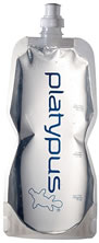
One simple, lightweight solution to this issue is to carry two, one-quart Nalgene water bottles and one, two-liter, Platypus-brand, 1.3 ounce, Platy Bottle (pictured at right) from Cascade Designs.
- Water-fording footwear: In addition to hiking boots, everyone should consider whether they want to also carry footwear for fording waterways and flooded areas.
- Safety glasses: Participants must have one pair of glasses for protecting their eyes while bushwhacking.
- Survival kit: Participants must carry a survival kit on their person.
Rations required
- Breakfasts: 8 days
- Snacks: 9 days
- Lunches: 9 days
- Dinners: 8 days
- Backup: 1 day
Land navigation info
Canadian 1:50,000 quadrangles: 41N/13 Bonner Head and 41N/12 Michipicoten Island (ordering info)
Click here to learn more about land navigation gear.
Preregistration required
If you would like to participate in this free backcountry adventure, or have any questions regarding it, please provide your full name, trail name, city, state, e-mail address, and phone number to the organizer:
Michael Neiger
Marquette, Michigan
1-906-226-9620
mneiger@hotmail.comRegistration: participants will receive a registration form by e-mail prior to the trip.
Liability waiver: participants are required to sign a liability waiver prior to the trip.


Return to top of page :: Return to home page
In God's wilderness
lies the hope of the world,
the great, fresh, unblighted, unredeemed wilderness.
—
John Muir, 1838-1914, Alaska Wilderness, 1890
If
you've been able to read this Web page...
thank a Teacher;
If you've been able to read this Web page in English...
thank a Veteran.
—Author
unknown
•
Copyright
notice •
Content Copyright 1984 to
2016-08-21
By Michael A. Neiger
• All rights reserved •
No part of this Web page or this Web site protected by copyright law may be reproduced, transmitted, or used in any form—including graphic, electronic, Web, mechanical or other form—or by any means—including photocopying, recording, taping, Internet distribution, information storage retrieval system, or by other means—for any purpose, except by a reviewer, who may quote brief passages, without the prior, express, written permission of the author.
Comments? Suggestions?
Dead links? Inaccurate info?
Contact the WebMaster, Michael A. Neiger, at mneiger@hotmail.com
Web site URL: www.MibSAR.com
Return to top of page :: Return to home page
You're here: MiBSAR's home page :: Trip beta page