A Rain-or-Shine Wilderness Class
Note: this class was changed from 3 days to 2 days due to a scheduling conflict
2-day
Basic to Advanced Land Navigation Class
Tactics & Strategies for working the bush with map, compass, protractor, & US Army Ranger pacing beads
Hiawatha National Forest
Point Iroquois area &
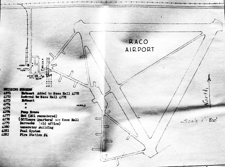
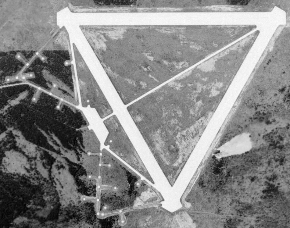
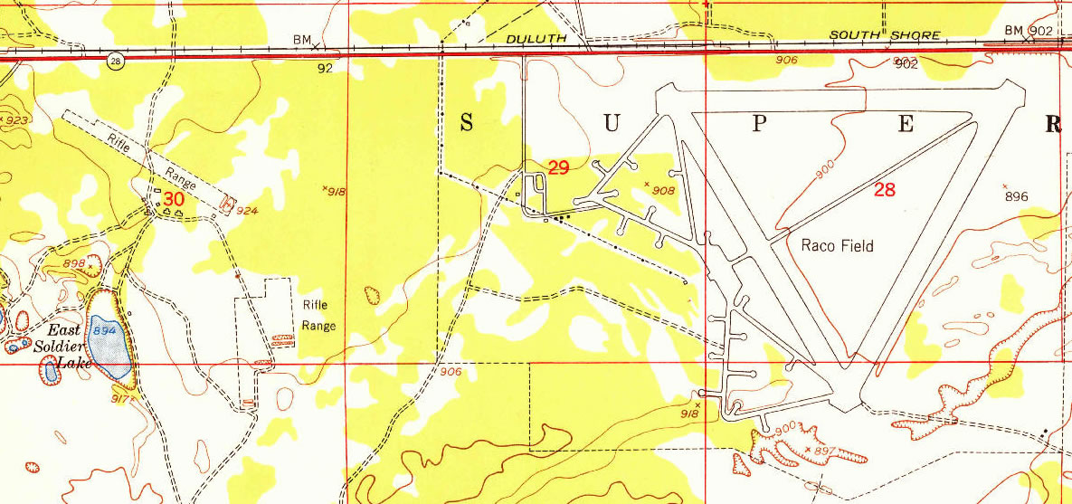
Abandoned 1945 Raco Army Airfield area
Brimley, Michigan
Eastern Upper Peninsula
August 8-9, 2020
Organized
by
Michael Neiger
Lead Investigator
Long Range Special Operations Group
Michigan Backcountry Search and Rescue
mneiger@hotmail.com
Marquette, Michigan
South Shore of Lake Superior
| Register for class | Class description | Class syllabus |
| Class info | Class resources | Acknowledgment |
| Free Upcoming Trips, Expeditions, and Wilderness Skills Classes | ||
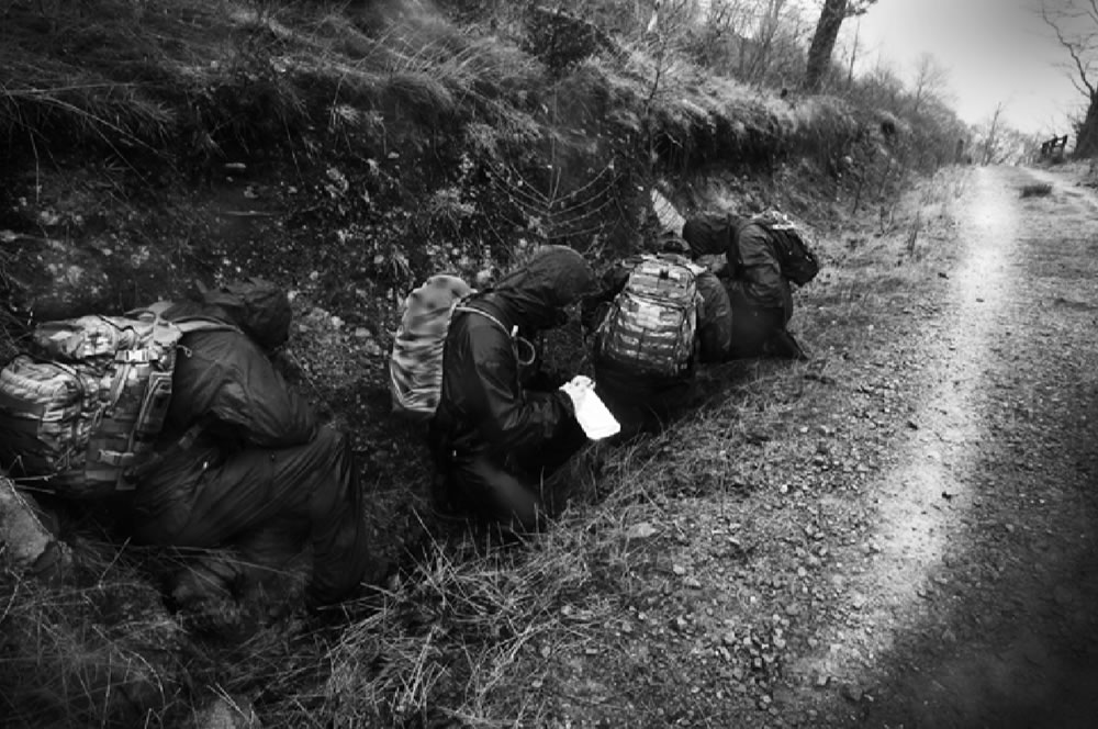
As part of its community outreach and preventive-SAR program, Michigan Backcountry Search and Rescue's (MibSAR's) Long Range Special Operations Group (LRSOG) is hosting a free, 2-day, Basic to Advanced Land Navigation Class: Tactics & Strategies for working the bush with map, compass, protractor, & US Army Ranger pacing beads.
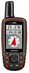
GPS unit NOTE: This class does not include instruction in the use of a Global Positioning System (GPS) unit.
Hand-held GPS navigational systems will be the subject of a separate class.
 |
|
| British Special Air Service (SAS) morale patch | |
 |
|
| U.S. Department of Defense (DOD) logo | |
 |
|
| National Association for Search and Rescue (NASAR) patch | |
This relaxed-pace, 2-day land navigation course — which is open to the general public* — is intended for:
- hardcore hikers and backpackers,
- wilderness guides
- outdoor recreation professionals
- SAR ground pounders working in remote areas,
- combat man-trackers,
- SWAT team members,
- and aspirants bound for the U.S. special operations forces (SOF).
It will consist of classroom PowerPoint lectures, table-top exercises, and hands-on field exercises aligned with land navigation best practices utilized by the best of the best:
- the British Special Forces (SF), including the Special Air Service (SAS);
- U.S. Department of Defense (DOD) Special Operations Forces (SOF) including Army Green Berets, Army Rangers, Navy Seals, Force Recon Marines;
- and National Association for Search and Rescue (NASAR) SAR operators.
*NOTE: Due to U.S. Department of State International Traffic in Arms Regulations (ITAR) controlling the transfer of tactical information — 22 C.F.R. Sections 120-130 — this class is only open to:
-
U.S. citizens;
International Traffic in Arms Regulations Compliance (ITAR) emblem - those granted U.S. permanent residence ('Green Card' holders);
- and those granted a 'protected person' status.
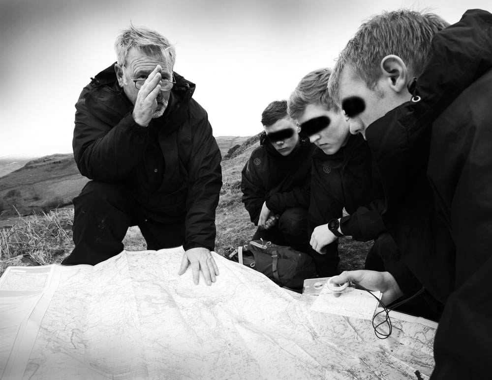
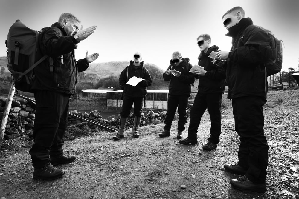
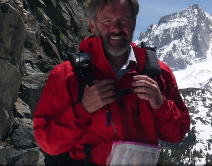
Team MibSAR's land nav mentor and ex-British Special Forces (SF) soldier Lyle Brotherton (left) training British Special Forces soldiers in land navigation. (Photo courtesy of Lyle Brotherton, click to enlarge)
 |
|
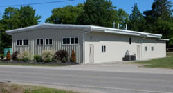
| The classroom | |
The classroom portion of this 2-day course will be held in a building along the south shore of Lake Superior, near Brimley, Michigan.
The air-conditioned classroom is roomy — with a capacity of 85 — and includes restrooms, tables, chairs, and WIFI.
 |
| Click to enlarge |
 |
| Click to enlarge |
 |
| Click to enlarge |
 |
| Click to enlarge |
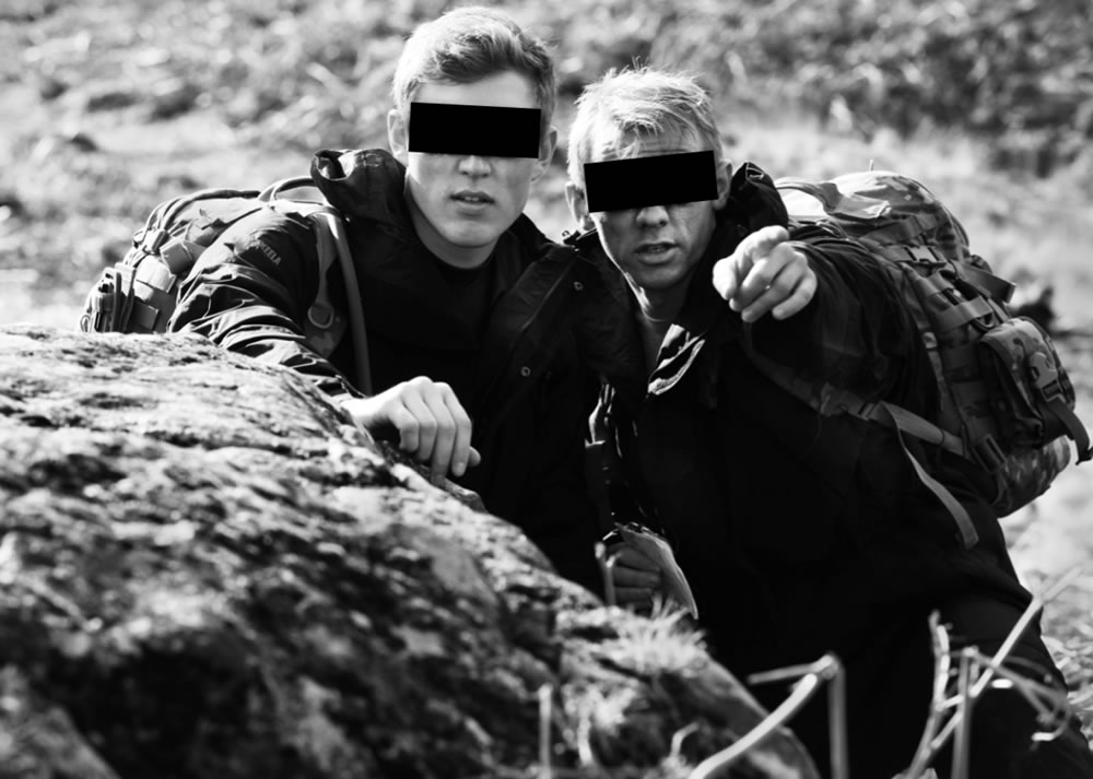
A variety of field exercises will take place outside the classroom building as well as in the nearby 880,000-acre Hiawatha National Forest, including in the bush around the old, abandoned, 1945 Raco Army Airfield, situated between Strongs and Raco.
This class will be a deep-dive into both macro and micro land navigation techniques:
- Types of maps
- Where to get maps
- How to waterproof maps
- How to fold maps
- How to pre-annotate a folded map section with UTM short coords
- How to protect maps
- How to carry maps
- Marginal info on maps
- Map legend symbols
- Map feature colors
- Map scales
- Map contour intervals
- Map datums
- Maps are not perfect
- Map norths
- True
- Magnetic
- Grid
- Map geo grids
- UTM
- LAT/LON
- USPLS
- USGN
- MGRS
- UPS
- USGN
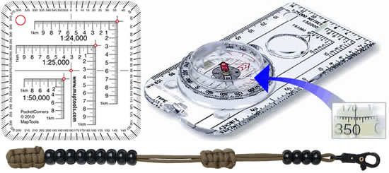
- How to use UTM roamer scales/plotters
- How to improvise a UTM plotter
- How to plot or calculate UTM coordinates
- How to convert coordinates
- Protractors
- Types
- Field-expediant
- How to use a protractor
- How to use a compass as a protractor
- How to measure straight-line and curved distances on a map
- Straight edge
- Floss
- Map wheel
- Map features
- Point
- Linear
- Shape
- Micro
- Contours lines and intervals
- Hill
- Saddle
- Valley
- Draw
- Spur
- Cliff
- How to calculate slope gradient
- Angle
- Percent
- How to calculate slope aspect
- How to use a clinometer
- The baseplate (orienteering) compass
- The prismatic sighting compass
- The wrist compass
- Parts of a compass
- Compass cardinal points
- Compass degrees
- Compass mils
- How to mark-up a compass bezel for boxing
- How to increase the accuracy of a compass
- How to set a bearing on a compass
- Magnetic declination
- Magnetic inclination
- Magnetic deviation
- How to adjust for magnetic declination
- How to recognize compass errors
- How to proof your compass for accuracy
- How to check for local magnetic errors
- How to orient/set a map with a compass
- How to orient/set a map to terrain features
- How to orient/set a map to terrain shape
- How to thumb a map
- The brace position for more accurate map and compass work while underway
- How to calculate a forward azimuth on object in the field with a compass
- How to plot an azimuth taken in the field on a map with a compass or a protractor
- How to calculate a forward azimuth on a object on a map with a compass or a protractor
- How to take a back azimuth on object in the field with a compass
- How to take a back azimuth on an object on a map with a compass or protractor
- Azimuth plotting and calculating on a map via:
- UTM easting grid lines (best)
- LAT/LON longitude neat lines (poor)
- USPLS section lines (very poor)
- How to fix your location via resection (triangulation) with back azimuths
- How to fix your location via resection (triangulation) with a ruler
- How to fix your location on a linear feature with a back azimuth
- How to estimate the location of a distant feature via intersection (triangulation)
- Route planning
- Go with the grain
- Follow ridges
- Avoid river valleys
- Escape routes
- Leverage satellite imagery
- How to navigate using:
- Attack points
- Route legs
- Handrails
- Collecting features
- Catching features
- Transit lines
- Leapfrogging
- How to use a compass to maneuver (box) around an obstacle blocking your route
- How to employ aiming off
- How to navigate using dead reckoning
- Radial arm navigating
- Celestial
- Terrain
- Using baselines to navigate
- Contouring
- Estimating distances while underway
- Visual estimation
- Roamer scales
- Ruler
- Timing
- Pacing
- How to follow an azimuth using fixed objects
- How to deal with drift while underway
- How to mark-up a map while underway
- Keep a nav log notebook
- Route navigation leg sheets
- How to hand-draw a map in the field
- How to compare and contrast route features
- U.S. Army Ranger Pacing Beads
- Field-expedient tally methods
- How to make pacing beads
- Where to buy pacing beads
- Metric pacing bead set-up
- English pacing bead set-up
- Using pacing beads
- Figuring your pace
- Factors influencing your pace
- Pacing v Timing
- Pedometers
- Night land nav techniques
- Relocation via looking
- Relocation via mapping
- Relocation via high ground
- Relocation via the wheel
- Relocation via the spiral box
- Relocation via line search
- Relocation via cliff/linear aspect
- Relocation via running back azimuths
- Relocation via sound
- Relocation via slope aspect
- Note reverse feature views for backtracking
- Recognizing parallel errors
- 11 common land nav errors
- Environmental navigation
- Wind direction
- Scent
- Temperature
- Vegetation
- Sound
- Aircraft
- Sun
- Moon
- The north star
- Migrating birds & animals
- Clouds
- How to use your watch to determine direction
- How to use a shadow stick to determine direction
- How to use the big dipper to determine direction
- Estimating time until sunset
- Subject: Basic and Advanced Land Navigation
- Location: Along the south shore of Lake Superior in Chippewa County, near Brimley, Michigan. Driving directions will be provided to participants prior to the class.
- When: 8:00 a.m. Saturday, August 8, to 5:00 p.m. Sunday, August 9, 2020
• Registration process: After thoroughly reviewing this webpage, reserve a spot in this class by joining the Michigan Hiking and Backpacking Facebook Private Group; clicking on the "Event" tab; clicking on the "going" tab for this trip; and sending Michael Neiger a 'friend request' and private message, after which he will send you a liability waiver form and a class registration form to print-out, fill-out, and return by snail mail.
• Questions: Private message or email class organizer Michael Neiger at mneiger@hotmail.com
• Cost: Free, participants pay their own expenses, share any group expenses (none)
• Participant limit: 12, plus instructor and assistant instructor
• Sign-up deadline: July 31, 2020 - Course instructors:
-
Lead Instructor: Michael Neiger, Founder & Lead Investigator with the Long Range Special Operations Group (LRSOG), Michigan Backcountry Search and Rescue (MibSAR), Marquette, Michigan, Facebook, website, bio, mneiger@hotmail.com
MibSAR -
Assistant Instructor: Todd Theoret, Owner & Lead Instructor at Diversity Wilderness Earth Living, Marquette, Michigan, Facebook, website, bio, todd@diversitywilderness.com
DWELL
-
- Level: While some prior knowledge of land navigation would be helpful, this course begins with the very basics and progresses into more advanced material, so it is appropriate for anyone, as long as they really want to develop their land navigation skills.
- Prerequisites: A participant must
- be 18 years old or older
- a non-smoker
- Banned: Participants should leave these at home, or in their vehicles:
- Firearms
- Alcohol
- Tobacco
- Non-prescription narcotics
- Pets
-
CDC COVID-19 protocols for this trip/exped/class:
COVID-19 
Please bring a mask for close-quarters interaction 
Please bring hand sanitizer to clean your hands or small surfaces as needed - Try to maintain 6-foot spacing intervals
- Try to wash hands often, especially after contacting any shared surface
- Try to clean shared surfaces regularly
- Try to wear a face mask (face covering) when in close-quarters (e.g.: when working on a map together, etc.)
- Monitor ourselves and each other for symptoms of COVID-19
- More COVID-19 info from the CDC
- Ration list:
- Participants are responsible for their own meals, and should bring 2 days worth of snacks and lunches, and water, for consumption during the day, either in the classroom or in the bush.
- Equipment and supplies to bring for classroom:
- Fine-point mechanical pencil
- Pen
- Protractor
- 6-inch ruler
- Small container of dental floss
- Pocket calculator
- Pad of paper for notes
- Clipboard
- Liquid-filled base-plate-style compass on neck lanyard
- COVID-19 mask
- Hand sanitizer
- Equipment and supplies to bring for fieldwork in bush:
- Folding chair and clipboard left at vehicle
- Daypack
- Plastic garbage bag to line pack and keep contents dry
- Eye protection when bushwhacking
- Insect repellent
- Water bottles
- Lunch and Snacks
- Rain jacket
- Rain pants
- Warm jacket
- Warm hat
- Small survival kit in ziplock bag: matches, lighter, fire starters, emergency blanket, whistle, pocket knife, small flashlight, granola bars, small backup compass
- Large ziplock bags to keep small items organized, accessible, and dry
- One-gallon ziplock bag to keep map in while using it.
- Liquid-filled base-plate-style compass on neck lanyard
- COVID-19 mask
- Hand sanitizer
- Classroom materials in ziplock:
- Fine-point mechanical pencil
- Protractor
- Small ruler
- A few feet of dental floss in tiny ziplock
- 3" by 5" notebook, or 3" by 5" cards
- Class assembly location: A map with driving directions will be provided to participants as the class nears.
- Bee-sting allergies: If you may be allergic to bee stings, notify everyone on the trip and carry an injectable epinephrine unit, such as an EpiPen or Ana-Kit, as prescribed by your doctor.
- Emergency contacts:
- All emergencies 911
- Chippewa County Sheriff (906) 635-6355
- Michigan State Police (906) 632-2217
- War Memorial Hospital (906) 635-4460
- Camping & Lodging: No campsites or lodging is provided for participants.
Campground options in the area include:- Hiawatha National Forest Soldier Lake Campground situated on M-28 adjacent to the west side of the old Raco Army Airfield, on M-28 between Raco and Strongs, Michigan
- Hiawatha National Forest Bay View Campground (on Lake Superior) situated on Lakeshore Drive (Iroquois Road), west of Brimley, Michigan.
- Michigan DNR Brimley State Park (on Lake Superior) on 6 Mile Road, just east of Brimely, Michigan.
- Willabee's Motel, on Lakeshore Drive (Iroquois Road), just east of Brimley, Michigan
- Bay Mills Resort & Casino, on Lakeshore Driver (Iroquois Road), just west of Brimley, Michigan
- Brimley Motel Suites on Lake Street Loop, in Brimley, Michigan
- Tourism info:
Team MibSAR's land nav mentor and ex-British Special Forces (SF) soldier Lyle Brotherton (not pictured) training British Special Forces soldiers in land navigation. (Photo courtesy of Lyle Brotherton, click to enlarge)
 |
|
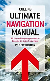
| The Ultimate Navigation Manual: All the Techniques You Need to Become an Expert Navigator, by Lyle Brotherton | |
Advanced Coastal Navigation, 2nd edition, by Coast Guard Auxiliary (Washington, D.C.: Coast Guard Auxiliary National Board, Inc., 1990
Analytical and Computer Cartography, by Keith C. Clarke (Englewood Cliffs, New Jersey: Prentice Hall, 1990)
Applied Cartography: Source Materials for Mapmaking, by Thomas D. Rabenhorst and Paul D. McDermott (Columbus Ohio: Merrill Publishing Co., 1989)
ArcGIS 9: Understanding Map Projections, by Melita Kennedy (Redlands, California: Environmental Systems Research Institute [ESRI], 2004)
Arizona Basic Search and Rescue, 2nd edition, by Aaron Dick, et al. (Hereford, Arizona: Arizona Search and Rescue Coordinators Association, Ltd, 2013
Basic Essentials of Map and Compass, by Cliff Jacobson (Merrillville, Indiana: ICS Books, Inc., 1988)
Basic GIS Coordinates, by Jan Van Sickle (Boca Raton, Florida: CRC Press LLC, 2004)
Basic Ground Search and Rescue in Canada: A Home Study Guide, by Wayne Merry (Atlin, British Columbia, Canada: Context North, 1999)
Basic Land Navigation (NFES 2865), by Mary Bogens, Michael Durfee, Lee Gardner, and Richard Streeper (Boise, Idaho: National Interagency Fire Center, Fire Training, 2007)
Be Expert With Map and Compass: The Complete Orienteering Handbook, by Bjorn Kjellstrom (New York, New York: Charles Scribner's Sons, 1976)
Coastlines: How Mapmakers Frame the World and Chart Environmental Change, by Mark Monmonier (Chicago, Illinois: University of Chicago Press, 2008)
Compass and Map Navigator: The Complete Guide to Staying Found, revised edition by Michael Hodgson (Guilford, Connecticut: The Globe Pequot Press, 2000)
The Complete Guide to Orienteering in North America: A Comprehensive Manual for the Outdoorsman, by Berndt Berglund (Toronto, Canada: Pagurian Press, 1979)
The Complete Idiot's Guide to Geocaching, by Jack W. Peter (Indianapolis, Indiana: Alpha Books, 2004)
A Comprehensive Guide to Land Navigation with GPS, third edition, by Noel J. Hotchkiss (Herndon, Virginia: Alexis Publishing, 1999)
Concepts and Techniques of Geographic Information Systems, by C. L. Lo and Albert K. W. Yeung (Upper Saddle River, New Jersey: Prentice Hall, 2002
Datums, Ellipsoids, Grids, and Grid Reference Systems (Defense Mapping Agency Technical Manual 8358.1), by John W. Hager, Larry L. Fry, Sandra S. Jacks, and David R. Hill (Fairfax, Virginian: Defense Mapping Agency Combat Support Center, 1990)
The Essential Wilderness Navigator: How to Find Your Way in the Great Outdoors, by David Seidman (Camden, Maine: Ragged Mountain Press, 1995)
Finding Your Way in the Outdoors, by Robert L. Mooers, Jr., (New York, New York: Popular Science Publishing Company, Inc., 1972)
Flattening the Earth: Two Thousand Years of Map Projections, by John P. Snyder (Chicago, Illinois: University of Chicago Press, 1993)
Fundamentals of Geographic Information Systems, fourth edition, by Michael N. Demers (Hoboken New Jersey: John Wiley and Sons, Inc., 2009)
Fundamentals of Search and Rescue, edited by Donald C. Cooper (Sudbury, Maine: Jones and Bartlett Publishers, 2005)
Geodesy for the Layman (Defense Mapping Agency Technical Report 80-003), (St. Louis AFS, Missouri: Defense Mapping Agency Aerospace Center, 1983)
Geographic Information Systems Demystified, by Stephen R. Galati (Boston, Massachusetts: Artech House, 2006)
Geographic Information Systems for Geoscientists: Modeling with GIS, by Graeme F. Bonham-Carter (Tarrytown, New York: Elsevier Science Inc., 1994)
Getting Started With Geographic Information Systems, fourth edition, by Keith C. Clarke (Upper Saddle River, New Jersey: Prentice Hall, 2003)
GIS Data Conversion: Strategies, Techniques, and Management, Pat Hohl (Santa Fe, New Mexico, 1998)
GIS for Dummies, by Michael N. DeMers (Hoboken, New Jersey: Wiley Publishing, Inc., 2009)
GIS: The Geographic Language of Our Age, by Knut Grinderud, Haakon Rasmussen, Steinar Nilsen, Arvid Lillethun, Atle Holten, and Øystein Sanderud (Trondheim, Norway: Tapir Academic Press, 2009)
Global Positioning Systems, by Scottie Barnes (Guilford, Connecticut: The Globe Pequot Press, 2000)
GPS for Dummies, by Joel McNamara (Indianapolis, Indiana: Wiley Publishing Inc., 2004)
The GPS Handbook: A Guide for the Outdoors, by Robert I. Egbert and Joseph E. King (Short Hills, New Jersey: Burford Books, 2003)
GPS Made Easy: Using Global Positioning Systems in the Outdoors, by Lawrence Letham (Seattle, Washington: The Mountaineers, 1998)
GPS Navigation Guide: Your Complete Resource for Outback Navigation, by Jack W. Peters (Collierville, Tennessee: GPS Navigator Magazine, 2003)
A GPS User Manual: Working With Garmin Receivers, by Dale DePriest (N.P., NP: 1st Books Library, 2003)
Green Beret's Compass Course, 4th edition, by SSG Don Paul (Kailua, Hawaii: Pathfinder Publications, 1985
Ground Search and Rescue: SAR 100 Participant Manual, 2nd Edition, by Andrew Spray, et al. (New Westminster, British Columbia, Canada: Justice Institute of British Columbia , 1999)
Ground & Urban Direction Finding Teams Tasks, by the Civil Air Patrol, United States Air Force Auxiliary (Maxwell AFB, Alabama: Civil Air Patrol, 2004)
Integrated Geospatial Technologies: A Guide to GPS, GIS, and Data Logging, by Jeff Thurston, Thomas K. Poiker, and J. Patrick Moore (Hoboken, New Jersey: John Wiley and Sons, Inc., 2003
Introduction to Geographic Information Systems, fourth edition, by Kang-tsung Chang (New York, New York: McGraw Hill, 2008)
Land Navigation Handbook: The Sierra Club Guide to Map, Compass, and GPS, 2nd edition, by W. S. Kals, revised by Clyde Soles (San Francisco, California: Sierra Club Books, 2005)
The Language of Maps, by Philip J. Gersmehl (Indiana, Pennsylvania: National Council for Geographic Education, University of Pennsylvania, 1991)
The Mapmakers, by John Noble Wilford (New York, New York: Vintage Books, 2000)
Map Projections Used by the US Geological Survey, 2nd edition (Geological Survey Bulletin 1532), by John P. Snyder (Washington, D.C.: United States Government Printing Office, 1982)
Mapping, by David Greenhood, revised by Gerald L. Alexander (Chicago, Illinois: University of Chicago Press, 1964)
Maps and Compasses, second edition, by Percy W. Blandford (Blue Ridge Summit, Pennsylvania: Tab Books, 1992)
Mapping Hacks—Tips & Tools for Electronic Cartography, by Schuyler Erle, Rich Gibson, and Jo Walsh (Sebastopol, California: O'Reilly Media, Inc., 2005)
Map Reading and Land Navigation (FM 21-26), (Washington, DC: Department of the Army, 1993)
Map Reading and Land Navigation (FM 3-25.26), (Washington, DC: Department of the Army, 2001)
Map Reading and Navigation, Manual 7, 2nd edition, by Emergency Management Australia (Dickson Australian Capital Territory, Australia: Emergency Management Australia, 2003)
Map Use: Reading, Analysis, and Interpretation, 7th edition, by Phillip C. Muehrcke and Juliana O. Muehrcke (Madison, Wisconsin: JP Publications, 2011)
Map Use and Analysis, third edition, by John Campbell (Boston, Massachusetts: WCB/McGraw-Hill, 1998)
Measurements from Maps: Principle & Methods of Cartography, by D.H. Maling (Oxford England: Perganon Press, 1989)
Mountain and Moorland Navigation, by Kevin Walker (Bangor, Great Britain: Pesda Press Ltd, 2016)
Orienteering, by Boy Scouts of America (Irving, Texas: Boy Scouts of America, 1974)
Orienteering, 2nd edition, by John Disley (Harrisburg, Pennsylvania: Stackpole Books, 1979)
Orienteering: Skills and Strategies, by Ron Lowry and Ken Sidney (Willowdale, Ontario, Canada: Orienteering Ontario, 1987)
Outward Bound Map and Compass Handbook, by Glenn Randall (New York, New York: Lyons and Burford Publishers, 1989)
Search Techniques Manual, by OSARVA Senior Search and Rescue Trainers (Orillia, Ontario, Canada: Ontario Search and Rescue Association, 2016)
Sniper Training and Employment (TC 23-14), (Washington, DC: Department of the Army, 1969)
Teaching Orienteering, 2nd edition, by Carol McNeill, Jean Cory-Wright, and Tom Renfrew (Doune, Perthshire, United Kingdom: Harvey's, 1998)
Thinking About GIS: Geographic Information System Planning for Managers, by Roger Tomlinson (Redlands, California: ESRI Press, 2003)
Ultimate Navigation Manual: All the Techniques You Need to Become an Expert Navigator, by Lyle Brotherton (London, UK; Harper Collins Publishers, 2011)
The Universal Grids: Universal Transverse Mercator (UTM) and Universal Polar Stereographic (UPS) (Defense Mapping Agency Technical Manual 8358.2), by John W. Hager, James F. Behensky, and Brad W. Drew (Fairfax, Virginian: Defense Mapping Agency Combat Support Center, 1989)
The Universal Transverse Mercator (UTM) Grid (Fact Sheet 077-01), by the US Geological Survey (Reston, Virginia: US Geological Survey, 2001
Using GPS: GPS Simplified for Outdoor Adventures, by Bruce Grubbs (Falcon Publishing, Inc.: Helena, Montana, 1999)
Using the UTM Grid to Record Historic Sites, by Wilford P. Cole, US Department of the Interior (Washington, DC: US Government Printing Office, 1980)
UTM: Using your GPS with the Universal Transverse Mercator Coordinate System, third edition, by John Carnes (Woodside, California: MapTools, 2007)
Wilderness Navigation: Finding Your Way Using Map, Compass, Altimeter, and GPS, by Bob Burns and Mike Burns (Seattle, Washington: The Mountaineers, 1999)
Wilderness Route Finder, by Calvin Rutstrum (New York, New York: Collier Books, 1967)
Free Upcoming Trips, Expeditions, and Wilderness Skills Classes
(subject to change)
September 4-7, 2020, Sierra Club Grand Island National Recreation Area Backpacking Trip, Alger County, Munising, Michigan
October 2-5, 2020, Sierra Club Fox River Wilderness Canoe Trip, Schoolcraft County, Germfask, Michigan
December 4-7, 2020, Sierra Club Winter Backpacking Trip, Pigeon River Country State Forest, Otsego County, Vanderbilt, Michigan
January 27-31, Sierra Club 5-day Snowshoe-and-Sledge Winter-Camping Trip, Alger County Highlands, Munising, Michigan
February/March, Sierra Club 15-day Snowshoe-and-Sledge Canadian Arctic Ocean Expedition, Ontario, Canada
~~~~
The best way to convince people
to defend
the wild areas
is to take them out and let them see wild splendor for themselves.
— John Muir 1838-1914
Also known as the Father of the National Parks, Muir was an influential Scottish-American naturalist, author, environmental philosopher, glaciologist, and early advocate for the preservation of wilderness in the United States of America.